G7 Cornwall: Map showing ‘no-go areas’ released by police ahead of summit

A map showing where residents and tourists will be permitted to go during the G7 summit in Cornwall has been released by police.
The map shows where residents’ cars will be checked, where they need to show ID and which roads will be closed during the three-day event in St Ives and Carbis Bay.
The summit will see world leaders - including Prime Minister Boris Johnson and US President Joe Biden - meet for crunch talks on the economy, trade and the pandemic.
Where will I be allowed to go?
The map, published for people who live in the St Ives and Carbis Bay areas, shows the full extent of ‘no-go’ zones.
It also shows which roads will be closed and where their diversions can be found.
In St Ives, there are three vehicle checkpoints listed for residents.
At these locations, residents will be expected to produce ID if they are travelling by car.
There is one in Trenwith Lane, near the turn off to Higher Trewidden Road, one near St Ives train station and a third in Belyars Lane.
Read more:
A fourth residents’ checkpoint is also in place to the south of Carbis Bay, near the crossroads of Trencrom Lane and Laity Lane.
St Ives - despite being some distance from the venue of the summit itself - still has certain areas which are residents-only.
Higher Stennack, the main road through the town, is only for those who live or work in the town - blocking access to central St Ives for most visitors.
There is also a large restricted area, where residents even on foot will be subject to ID checks, on the Carbis Bay side of St Ives - mostly in Belyars Lane and the area next to Tregunna Castle.
These restricted areas are only accessible by road via the roadblocks, which will be manned by police.
Road closures - where are they?
St Ives Road, which would normally connect St Ives to the A30 and Carbis Bay and Lelant, is closed from June 10 to 13.
From June 7 to 13, there is also a 20mph speed limit in force on the road, as well as parking restrictions on the stretch between Lelant and Carbis Bay.
For Carbis Bay, the entire town is effectively closed off for public use for the duration of the summit, with the town only accessible by road via the roadblocks.
The same goes for Lelant, where a residents-only zone stretches down to the end of St Ives road leading onto the A30.
The St Ives Road diversion stretches from Higher Stennack, around past Halsetown, past Trevarrack, and winds back around to the A30 to meet at the Hayle Bypass.
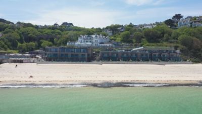
Aside from these restrictions, Carbis Bay Beach is also entirely off-limits - including for residents - while the summit goes on.
The map has been met with some confusion by residents on social media.
Superintendent Jo Hall, of Devon and Cornwall Police, said officers had worked with locals to determine the restrictions.
She explained: “We are working hard to minimise the impact of the Summit on local communities and we are engaging regularly with residents and other partners in the affected areas.
Read more: