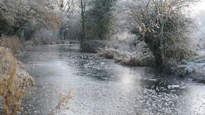
What are the chances of a white Christmas in the South East this year?

There will be disappointment for some on Christmas morning, as weather experts say the chance of a white Christmas in the south of England is low.
This month's cold spell had prompted hopes of a dusting of snow over the festive period.
After the coldest week since 2010 was recorded at the University of Reading’s Atmospheric Observatory last week, in which temperatures of below -5.0 °C were observed on four days in a row, conditions have now significantly warmed up.
Temperatures reached 12 °C in the early hours of the morning of Monday, 19 December at Reading’s Observatory.
And the mild weather will continue this week and through to Christmas Day, according to Met Office forecasts for the South East.
One University of Reading meteorologist said that with milder conditions looking set to stay, it's unlikely much of the UK will get any of the white stuff over Christmas.
Dr Peter Inness, of the University of Reading’s Meteorology Department, said: “For the Christmas period, widespread snow appears unlikely and it looks like we're going to stay very much in this milder air up until Christmas.
“The north of Britain could have some much colder weather coming in on Christmas Day itself, so if there is going to be any snow on Christmas Day in the UK, it's going to be somewhere in the north - Scotland, Northern Ireland or the north of England.
“But in general, it's staying warmer. So southern Britain doesn’t look like it's going to get any snow over Christmas.”
The definition that the Met Office uses to define a white Christmas is for one snowflake to be observed falling in the 24 hours of 25 December somewhere in the UK.
For thousands of people travelling at Christmas, the lack of snow is likely to come as a relief. Cold weather earlier this month caused disruption in some parts of the country.
Dr Inness said last week's cold weather was due to north-easterly wind coming from colder regions such as the Arctic, Scandinavia and Siberia.
The weather expert said cold spells such as the one the UK experienced last week are likely to become less frequent as global temperatures are set to continue to rise in the long-term.
He added: “Even though on average, the climate is set to get warmer, we still get weather, which is variability of the climate on a short-term basis - such as the cold spells like we had last week.
"In a warmer world scenario, what will happen is that cold snaps like these will probably be fewer and further between. When we do get cold spells like that, they will probably be not as extreme as they were in the past.
"Think back to the really cold winter of 1962-63. There was a cold spell then that lasted almost three months, when the temperatures were similar to what we had last week.
"We're probably not going to see winters like that again. So when we do get the cold spells, it will be a week or two weeks at most.”
According to the Met Office, since 1960, around half of the years have seen at least 5% of the network record snow falling on Christmas Day. This means we can probably expect more than half of all Christmas Days to be a 'white Christmas'.
However, the Dickensian scene of widespread snow lying on the ground on Christmas Day is much rarer. There has only been a widespread covering of snow on the ground (where more than 40% of stations in the UK reported snow on the ground at 9 am) four times since 1960—in 1981, 1995, 2009 and 2010.