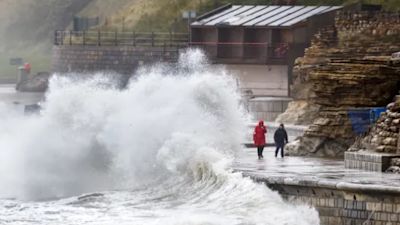
Storm Christoph set to lash UK this week bringing up to 200mm rain

Flood warnings have been issued for many parts of the country with heavy rains and gale force winds set to pound the UK this week as Storm Christoph sweeps in from the Atlantic.
Some areas of the UK could see up to 200mm of rain over the first half of the week, much of it falling on already saturated ground.
An amber warning has been issued for Tuesday and Wednesday for central northern England, affecting an area around Manchester, Leeds and Sheffield and stretching down to Peterborough where up to 70mm of rain is expected.
UK braced for cold snap as Storm Bella gives way to snow and ice warnings
Storm Alex: Flooding risk as UK lashed by heavy rain and gusts of up to 65mph
Isolated spots, particularly in the northern Peak District and parts of the southern Pennines could see as much as 200mm.
Met Office chief meteorologist Dan Suri said: “Following a cold spell where the main hazard was snow, our focus now turns to notably heavy rain moving across the UK this week.
“Some locations could see over 100mm of rain falling through the course of just a couple of days, with up to 200mm possible over higher ground.
“These amounts of rainfall along with snow melt present a real threat of flooding and people should keep a close eye on flood warnings from the Environment Agency and Natural Resources Wales.”
An amber warning has been issued stating there is a “danger to life” due to fast-flowing or deep floodwater and a “good chance some communities cut off by flooded roads”.
A yellow rain alert is also in place for most of northern England and Wales from Tuesday to Wednesday, before most of the UK falls into the warning on Thursday.
The Environment Agency has issued 11 local flood warnings covering parts of Yorkshire, Derbyshire, Lancashire, Greater Manchester, Merseyside and Cheshire.
There are a further 61 flood alerts, meaning flooding is possible in the area, although the number is expected to increase significantly as the impact of the first heavy rain is felt overnight.
The Environment Agency has urged people living in those areas to prepare for the risk of significant flooding as early as Tuesday morning, as the heavy rain hits already saturated ground.
Defences including temporary barriers and the opening of flood storage reservoirs are being prepared, the Environment Agency said.
There will be cooler, calmer conditions towards the later half of the week going into the weekend as Storm Christoph blows its way across the North Sea, leaving strong winds along the east coast.
As of Wednesday afternoon until noon on Thursday, a yellow weather warning for snow and ice is in force stretching from Dundee to Elgin and across to the east coast of Scotland.
It warns there is a small chance of travel disruption, as well as a risk of power cuts and also injury from slips and falls on icy surfaces.