Two months’ rain could fall in three hours as heatwave triggers thunderstorms

The UK could get more than two months’ rainfall in just a few hours as thunderstorms move in across the country.
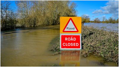
Forecasters are preparing for a “worst-case scenario” of up to 150mm on Monday afternoon and evening in some places – more than twice the 70mm average for the month of August – with heavy rainfall already reported across Devon and Cornwall in the south-west of England.
The worst affected areas are expected to be between Birmingham and Cumbria, from around 4pm on Monday, although almost the whole of the UK is covered by a Met Office weather warning between now and Thursday evening.
It follows an intense period of very hot weather which saw temperatures reach 34C at Herstmonceux in East Sussex on Sunday, the fourth consecutive day the thermometers passed 30C in the south of England – although there is every chance hot weather will remain, with temperatures of up to 36C possible across the south coast at the beginning part of the week.
And while temperatures will ease slightly, records could be broken as the hot, muggy weather is set to continue.
ITV Weather Presenter Lucy Verasamy on what the week's weather could have in store
A hot, humid week is in store with blazing strong sunshine, cloudier muggy conditions and hit and miss intense prolonged downpours with thunderstorms. After temperatures peaked last Friday at 36C - one of our hottest August days since 2003 - and it's not over yet.
We're expecting temperatures to nudge a little higher in the next few days with near 37C or more likely.
At this stage we're likely to rival 1995 - currently the hottest August on record - where we saw four consecutive days of temperatures over 32C (90F). Along with unbearably hot days, expect muggy warm and uncomfortable nights as temperatures take hours to slide just a few degrees.
London and parts of the south east are likely to keep hot evenings near 30C and not be much below 25C after dark.
As well as being hot and muggy, the air is increasingly unstable and has the perfect set up for widespread intense, prolonged rain associated with hit and miss thunderstorms.
Some places will be at risk of seeing a high amount of rainfall in a short space of time leading to excess, and at times fast flowing, surface water as it struggles to filtrate into the sun baked ground.
This heat has been drawn in from the Continent and North Africa and is sitting firmly across the UK for the time being - with signs of a slight respite towards the weekend as temperatures drift down to a more manageable but still very warm 26-28C.
Scotland, Northern Ireland and northern England will escape heat - here temperatures remain modest, giving a more comfortable feel - but will be prone to more cloud and a heightened risk if downpours and thunderstorms generated from the hot, humid air further south.
The far north of Scotland is the only part of the UK not currently covered by Monday’s broad weather warning.
Northern Ireland is also affected from Monday until Wednesday.
The Environment Agency said it would update its flood warnings and alerts as the situation changes, and said those wanting to keep up to date can check on the Gov.uk website, or social media, or through the Floodline service on 0345 988 1188.
The Met Office warned that flash flooding could cause travel disruption and power cuts, but also cautioned about the risks caused by fast flowing or deep floodwater.
It came as a 12-year-old girl died after going missing in the River Leven, near Balloch Bridge, Loch Lomond, in the west of Scotland on Sunday evening. Her body was discovered by emergency services hours later.
In Norfolk, a woman in her 30s died after getting into difficulties in the sea at Waxham on Sunday.
HM Coastguard dealt with 340 incidents across the whole of the UK on Saturday – the highest number of call-outs in a single day for well over four years.
There were a further 335 incidents on Sunday.
In Dorset, traffic police said a colleague stopped a father with four children arriving near the coastal beauty spot Durdle Door, only to find it had closed.
The group had travelled down from Birmingham and spent more than six hours in their vehicle only to be turned back, police said.
The current heatwave is nowhere near the infamous summer of 1976, one of the longest in living memory in the UK, when temperatures reached 32C or higher somewhere in the country for 15 consecutive days.
Dogs left in locked car for two hours near Cornwall beach during heatwave
People urged to use less water after demand spike during heatwave